TODAY
Today Partly sunny. highs in the mid 70s. northwest wind 5 to 10 mph.
TONIGHT
Tonight Mostly clear. lows in the lower 50s. northwest wind 5 to 10 mph.
MONDAY
Monday Sunny. patchy smoke in the afternoon. highs in the mid 80s. north wind 5 to 10 mph.
MONDAY NIGHT
Monday night Mostly clear. patchy smoke. lows in the upper 50s. north wind 5 to 10 mph.
TUESDAY
Tuesday Sunny. highs in the mid 90s. north wind 5 to 10 mph.
TUESDAY NIGHT
Tuesday night Mostly clear. lows in the lower 60s.
WEDNESDAY
Wednesday Sunny. highs in the upper 90s.
NWS Forecast: 1127 AM PDT SUN AUG 2
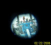
I held my digital
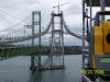
camera at the eye piece of our 32 power Trimble survey instrument shown in the first picture
and snapped this picture of the Iron workers rigging this compactor off of the
Gig Harbor Tower, south side.
[Home]
[Kalama Display Live]
[My Tacoma Washington Forecast.html]
[THE WOODLAND,KALAMA, KELSO-LONGVIEW FORECAST]
[SE ALASKA, KETCHIKAN,GRAVINA ISLAND.html]
[Northern Hemisphere Animation]
[Tide INFO Tacoma Narrows Bridge, Washington]
[stock page.htm]
[weather data history]
[moon phase.htm]
[Vantage pro 2 ISS]
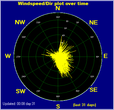
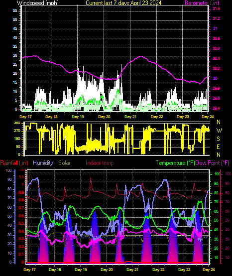
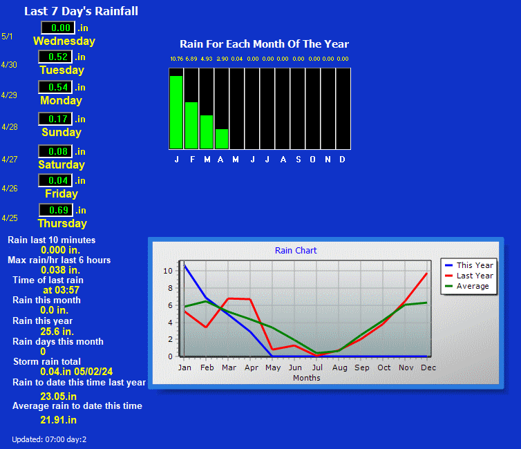
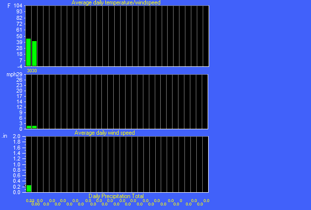
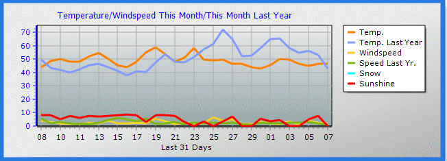
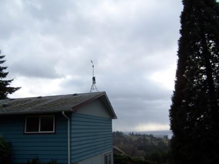
This is a Summary of the weather data at
my Weather Station 2 miles above I-5 at exit 27

[Home]
[Kalama Display Live]
[My Tacoma Washington Forecast.html]
[THE WOODLAND,KALAMA, KELSO-LONGVIEW FORECAST]
[SE ALASKA, KETCHIKAN,GRAVINA ISLAND.html]
[Northern Hemisphere Animation]
[Tide INFO Tacoma Narrows Bridge, Washington]
[stock page.htm]
[weather data history]
[moon phase.htm]
[Vantage pro 2 ISS]


