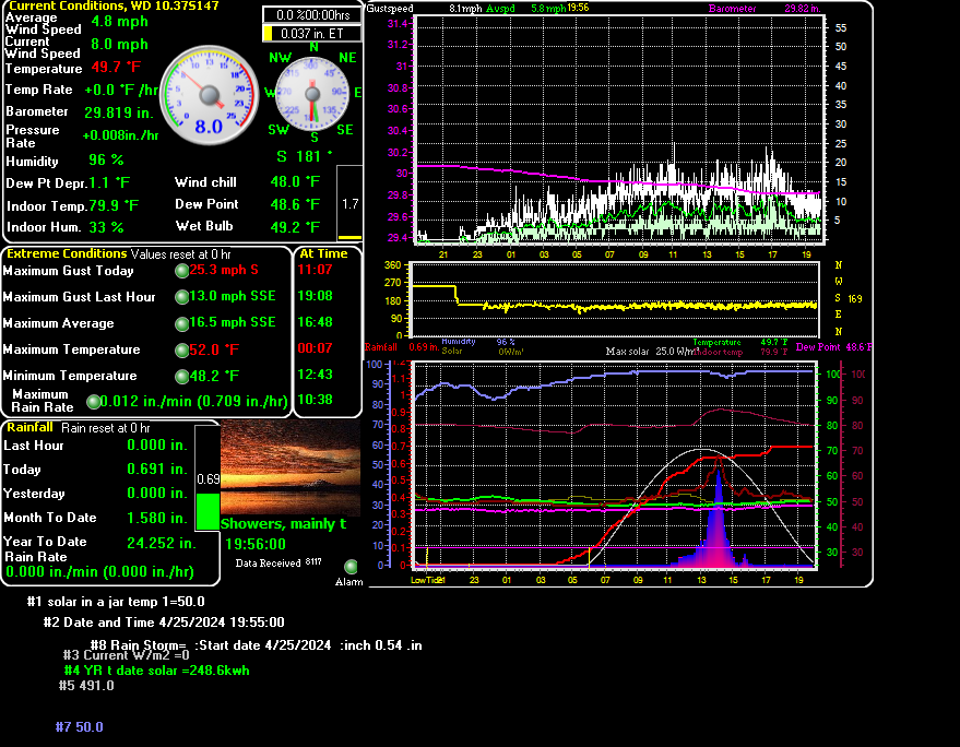


Real time Kalama Weather Data, Green Mountain Road, Kalama WA Note this live data uses flash of which is being discontinued is why i have the FreshWDLmaster also running below

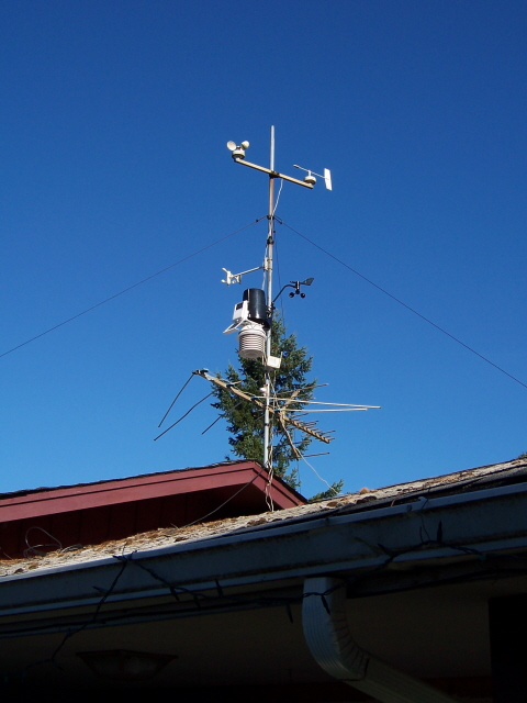
Note: This data is now collected with a Davis Vantage Pro 6153
| Point Forecast: KALAMA WA
DOCMARVWEATHER 45.98N 122.81W (Elev. 420 ft) |
Last Update: |
|
|
|
| [dashes/dots] | [b/w] | [hide menu] | ||||||
|
||||||
|
||||||
|
||||||
| [dashes/dots] | [b/w] | [hide menu] | ||||||
|
||||||
|
||||||
|
||||||
|
|||||||||||
|
|||||||||||
| CLICK HERE TO SEE THE NAVY FORECAST | Temps are from Weather Street: Tacoma WA Weather | Model: NOGAPS
Area: EASTPAC Previous 12 hour data (i.e.. from Sun am back to Sat. pm)
|
Temps are from Weather Street: Tacoma WA Weather | Model: NOGAPS
Area: EASTPAC Previous 12 hour data (i.e.. from Sun am back to Sat. pm)
|
|---|
WEATHER AT THE COAST for CLAM DIGGING or PLAYING AT LONGBEACH?
THIS IS A NICE SITE FOR FISHING WASHINGTON AND ALASKA WATERS!!!!
(NEW) CHECK OUT WEATHERUNDERGROUNDS NEW WUNDERMAP
CLICK HERE TO View The Hadaller Family's Weather in hourly detail
Click Here to see the latest data from Weatherunderground
| Stop Map | No Tracks | Total Precipitation | Show Severe | Regional Radar |
|
�
A d v a n c e d R a d a r T y p e s C L I C K � |
Radar Tip: Try clicking and dragging on the map
above to make a zoom box.
Click Advanced Radar Types on the left to select
scientific radar types.
|
| Lightning Key: | � Map of Lightning Detector Network |
AREA FORECAST DISCUSSION
THIS NEXT
FRAME WAS ADDED PER A REQUEST FROM JEFF Rose ENJOY!!
Weather Forecasts |
Weather Maps |
Weather Radar
Click here to go to the Longbeach Washington site if you Like Clam Digging?
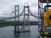
Surveying the Narrows
I took this photo with
a digital camera through the eye piece of a Trimble 5601
the Iron workers are removing the cable compactor off of the Gig Harbor
Tower, south side.
Click here to see the latest
forecast model map from weather underground
Marv's
Forecast for Tacoma
This data was updated:
Tuesday December 10, 2013 01:01:57 PM -0800 a
link to the jet stream
http://www.nws.noaa.gov/forecasts/graphical/sectors/washington.php
Click Here to see
the latest forecast from the Navy
this site is hosted by
If you would like to
help with the cost of this web-site
a donation would be appreciated.
NEXRAD Radar
Type
Base Reflectivity 0.50� Elevation
124 NMI
Portland Base Reflectivity 0.50 Degree Elevation Range 124 NMI
Stop Map
No Tracks
Total Precipitation
Show Severe
Regional Radar
US
Radars
Radar Tip: Try clicking
and dragging on the map above to make a zoom box.
Stop Map
Storm Tracks
Total Precipitation
Show Severe
Regional Radar
�
A
d
v
a
n
c
e
d
R
a
d
a
r
T
y
p
e
s
C
L
I
C
K
�


Home
Printable Forecast
Text Only Forecast
Forecast Discussion
TCM
47.250
-122.459
katx
otx
Tacoma Area
Downtown Tacoma
![]() weather.gov
weather.gov


Langley Hill Radar (best viewed with google chrome or fire
fox)
AREA FORECAST DISCUSSION
Cool
Graphical Forecasts - Washington State


by
The JavaScript Source


